
 |
 |
 |
 |
 |
 |
 |
 |
Welcome to the Cornwall Tourism Magazine - Cornwall Tourism Magazine - Perranporth page.
|
|
 |
 |
 |
 |
 |
 |
 |
 |
 |
 |
 |
 |
 |
 |
 |
 |
 |
 |
 |
 |
 |
Cornwall Tourism Magazine - Perranporth.
Perranporth is a small seaside resort, more of a village than a town, that is located on the northern coast of Cornwall about 7 miles to the southwest of Newquay and is very popular for its stunning flat, sandy beach which extends for nearly 3 miles. The village's Cornish name ( Porthpyran ) means Saint Pirans' cove and it is believed that Saint Piran ( one of Cornwall's patron saints ) founded a church at Perranzabuloe near Perranporth in the 6th century where legend has it that he was washed ashore after being tied to a milestone by the Irish, thus creating a miracle. But today, it is the beach at Perranporth that attracts most visitors as it is easily accessed and large enough, even when the tide is in, to cater for many hundreds of people.
 |
 |
 |
 |
St Piran's Oratory at Penhale sands.
After landing on the Cornish coast at Perranzabuloe, St Piran along with his Christian converts founded the Abbey of Lanpiran, with Piran as abbot. His first Oratory at Perranzabuloe was a small building and abandoned in the 10th Century because it was taken over by the sand dunes. A new church ( called the Old Church! ) was then built in the 12th Century and was used up to the late 18th century when it too was abandoned due to the encroachment of the sand dunes in 1835. St Piran's Oratory was uncovered and its remains excavated in 1910 but was eventually buried by the dunes again where its remains are still buried to this day. The site of St Piran's Old Church and the 10th Century cross located next to it was excavated in 1919. St Piran's Cross, which is believed to be the earliest recorded stone cross in Cornwall, still stands in the dunes between the oratory site and the graveyard of the old church.
 |
 |
 |
 |
St Piran's Cross |
St Piran's Oratory - 1960's |
Remains of Old Church |
Millennium Sundial monument. |
History or Perranporth.
The history of Perranporth goes back to the Iron age and very probably, well beyond that. Just to the east of Perranporth there is an old Iron Age fort called St Piran's Round which is an amphitheatre, which is quite significant in size ( and would easily seat an audience of hundreds) where it is believed ancient games and possible mysterious religious rituals were held back in the Iron Age days and possibly after that period. Apart from its religious heritage with St Piran, Perranporth was really just a small village which would have had a small fishing fleet from the 10th Century up until the 18th Century, but from then on, it became a Tin Mining town which exploded in the 19th Century. You can see the evidence of this all around and the evidence of this can be seen all around Perranporth with countless small workings and mounds.
The Hanover shipwreck.
There have been a large number of shipwrecks over the years,as you would imagine, but one which is very famous is the wreck of the Hanover in 1763 which gave its name to Hanover Cove. The Hanover was returning from Portugal to Falmouth when a severe gale caused her to veer of course and into the rocks. Of the 27 crew members only 3 are known to survive,but what makes the Hanover so special is that it was full of gold and valuables worth in those days around £60,000, which today is worth around £50 million, and it is evidently still under the sand because although over the years divers have brought up cannons, the ships bell and other artifacts, so far the gold has not been recovered. However, before you go and buy an underwater metal detector and a diving suit, the wreck is buried under at least 4 metres of sand, under the sea, and it is highly probable that the gold was removed soon after the ship was wrecked. But then again, you never know.
WW2 and Spitfires.
Nearby Perranporth Airfield was a fighter base in the second world war and various squadrons of Spitfires were based there throughout the war. Many of the fighter pilots came from the Commonwealth and those countries under German occupation and they saw some very heavy fighting both over Uk soil and in Northern France as they were part of the 1941 RAF attack strategy called Operation Circus which was designed to to destroy the Luftwaffe's fighter force in France by bombing their bases and military installations and attacking the luftwaffe's fighters when they came up to intercept. As a consequence, many young pilots lost their lives. Today the airfield is one of the most important remaining WW2 airfields and there are many interesting artifacts there from the war period. It is still in use today, although you wont find and Spitfires or Hurricanes there today.
 |
 |
 |
 |
Hanover Cove - wreck site |
Hanover Cove |
Spitfire at Perranporth Airfield |
Monument at Perranporth Airfield |
Beach's in Perranporth.
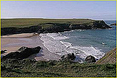
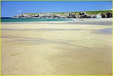
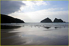
Porth Joke Beach (known locally as Polly Joke) lies between the headlands of Kelsey Head and Pentire Point West. Its best beach though is Holywell Bay which sits in front of the town. This is a large sandy beach, thought ideal for families, offering great views across Perran Bay to Perranporth in the distance. If you’re lucky you might catch a glimpse of bottlenose dolphins.
 |
 |
 |
 |
Porth Joke Beach - Perranporth |
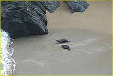
Seals on Porth Joke Beach |
Holywell Bay - Perranporth |
Holywell Bay - Perranporth |
 |
 |
 |
 |
 |
|
Find the towns in Cornwall - by map.
Please use the map to locate the town of your choice and click on the appropriate icon and link which will take you to the relevant towns page where you can find out about its history, what to do and see there, local villages, images and other interesting items and facts. Alternatively, you can use the manual selection section below where we have alphabetically listed most of the major towns in Cornwall in their appropriate region. To use it, just click on a Town name button and the link will take you to its relevant page. Using the map. To locate a town, please put your curser on the map face, left click your mouse and then use it to move a scroll around the map. The towns will all have a small white balloon icon so when you wish to view a town page, left click on the towns icon, and then click on the link that will appear with the towns name on it. You will then be taken to the towns relevant page. You will find the map on all town pages so if you want to look up another town, just locate it on the map and click on the appropriate icon as described here. Map of Cornwall - Click on the balloon icon link to a town and click on the link when it opens.
 |
 |
 |
 |
 |
 |
|
 |
Our business methodology is very simple. We are promoting Cornwall as an all year round holiday destination and to do this more effectively, we need your local stories and feed back from your visit to Cornwall which we will post on a dedicated page, so please send us your thoughts and any tourism related local stories or your feedback on your stay in Cornwall. We will publish them on the website every two weeks and we will give the best story of each fortnight a free Cornwall Pass so please send your stories and information to us on editor@cornwalltourismmagazine.com and we will publish them for you.
 |
Advertising and Distribution Information | Magazine Advertising Rates | Magazine Advertising pre-booking form
The Cornwall Pass | Information Privacy Policy | Cornwall Tourism Magazine
The Cornwall Tourism Magazine . Copyright (c) 2011 - 2023 Cornwall Tourism Magazine. All rights reserved. Website Design In Cornwall
|


